Applied Geography

Dr. Senjuti Nandy

Room No. - NA,

+91-7003167500

nandyseju2010@gmail.com

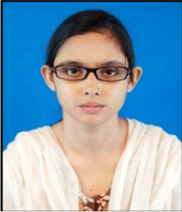
Dr. Senjuti Nandy is Assistant Professor of Geography in the Department of Geography at Ravenshaw University, Cuttack, Odisha. She started her teaching career by joining as a regular faculty member at Ravenshaw University in May 2022. She has completed her Ph.D. in Applied Geomorphology from Visva-Bharati, Santiniketan, West Bengal (Topic: HIMALAYAN UPPER PINDAR RIVER BASIN: A STUDY IN LANDFORM AND SETTLEMENT). She is a life member of several professional bodies/societies such as the Indian National Cartographic Association (INCA), the Institute of Indian Geographers (IIG), the Geographical Society of West Bengal, etc., and also has a lifetime subscription to Himalayan Geology (Journal) of Wadia Institute of Himalayan Geology. Dr. Nandy has been working on Physical Geography with a specialization in Geomorphology in the highaltitudinal Himalayan region. Her current research focuses on the assessment of tectonic activity and seismic hazard analysis. Recently, she got a chance to present her work at the
2022 IGU Centennial Congress in Paris, France.

Selected Publications

  1. Padder A. H., Nandy S., Kothyari G. C., Jani C., Lakhote A., Kandregula R. S., Joshi N., Taloor A. K., Chauhan G., Thakkar M. G. (2022). Geomorphometric Appraisal for Seismic Hazard Assessment in the Chenab River Basin of the NW Himalayas, India. Geotectonics, Springer,  56(3). DOI: https://doi.org/10.1134/S0016852122040069 (ISSN No. 1556-1976)
  2.  Das S., Sarkar A., Mina U., Nandy S., Saasdat Md. N., Agrawal G. K., Rakwal R. (2022). Trends in Summer-Time Tropospheric Ozone during COVID-19 Lockdown in Indian Cities Might Forecast a Higher Future Risk. Atmosphere, MDPI, 13(7). DOI: https://doi.org/10.3390/atmos13071115 (ISSN No. 2073-4433)
  3.  Karmokar S., Halder M., and Nandy S. (2021). Identification of Paleochannels Using Remote Sensing: A Study on Upper Gangetic Delta in Parts of Murshidabad and Nadia Districts, West Bengal. Remote Sensing in Earth Systems Sciences, Springer, 4(1-2), 104-120. DOI: https://doi.org/10.1007/s41976-021-00047-0 (ISSN No. 2520-8209)
  4. Nandy S., Taloor, A. K., and Kothyari, G. C. (2021). Mapping of major river terraces and assessment of their characteristics in Upper Pindar River Basin, Uttarakhand: A geospatial approach. Quaternary Science Advances, Elsevier, 4, 1-13. DOI: https://doi.org/10.1016/j.qsa.2021.100032 (ISSN No. 2666-0334) 
  5. Nandy S. (2021). Assessment of terrain stability zones for human habitation in Himalayan Upper Pindar River Basin, Uttarakhand using AHP and GIS. Environmental Earth Sciences, Springer, 80(9). DOI: https://doi.org/10.1007/s12665-021-09634-2 (ISSN No. 1866-6299)